Circular Walks from The King’s Head
Each walk starts and finishes at The King’s Head, Wye. Distances are round-trip via footpath and the North Downs Way; all buildings are listed by Historic England.
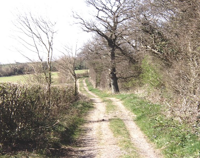
Hero photo: Dylan Moore / Geograph, CC BY-SA 2.0
Stats for the catalogue
Walks in scope
57
Grades
24 Grade I
· 33 Grade II*
Distance from Wye
0.4 – 5.0 mi
Listing dates
1951 – 1989
Spanning 20 parishes in the Kent Downs AONB around Wye.
Walks by parish
| Parish | Walks | Grade I | Grade II* | Nearest to Wye |
|---|---|---|---|---|
| Non Civil Parish | 9 | 1 | 8 | 3.3 mi |
| Chilham | 5 | 4 | 1 | 3.2 mi |
| Brook | 5 | 2 | 3 | 1.7 mi |
| Mersham | 5 | 3 | 2 | 4.0 mi |
| Elmsted | 4 | 1 | 3 | 4.0 mi |
| Challock | 3 | 0 | 3 | 3.1 mi |
| Wye with Hinxhill | 3 | 1 | 2 | 0.4 mi |
| Smeeth | 3 | 1 | 2 | 4.6 mi |
| Brabourne | 2 | 1 | 1 | 3.4 mi |
| Godmersham | 2 | 2 | 0 | 2.3 mi |
| Hastingleigh | 2 | 1 | 1 | 3.1 mi |
| Molash | 2 | 1 | 1 | 3.8 mi |
| Waltham | 2 | 1 | 1 | 3.7 mi |
| Boughton Aluph | 2 | 1 | 1 | 1.6 mi |
| Chartham | 2 | 0 | 2 | 4.9 mi |
| Crundale | 2 | 1 | 1 | 2.2 mi |
| Eastwell | 1 | 0 | 1 | 2.8 mi |
| Sevington with Finberry | 1 | 1 | 0 | 3.9 mi |
| Great Chart with Singleton | 1 | 1 | 0 | 4.9 mi |
| Westwell | 1 | 1 | 0 | 4.0 mi |

Grade II*
Bower Farmhouse
straighten 4.6 mi
timer 185 min location_on Mersham

Grade I
Mersham Manor
straighten 4.6 mi
timer 186 min location_on Mersham

Grade I
Church Of St John The Baptist
straighten 4.6 mi
timer 186 min location_on Mersham

Grade II*
Old Leigh Place
straighten 4.7 mi
timer 189 min location_on Elmsted
Grade II*
Lodge House
straighten 4.8 mi
timer 193 min location_on Smeeth

Grade I
Godinton
straighten 4.9 mi
timer 196 min location_on Great Chart with Singleton

Grade II*
Mystole Coach House
straighten 4.9 mi
timer 197 min location_on Chartham
Grade II*
Mystole House South Mystole West Wing
straighten 4.9 mi
timer 198 min location_on Chartham
Grade II*
Evegate Manor
straighten 5.0 mi
timer 198 min location_on Smeeth